
Features Waldinfoplan
The app was designed for use in the forest and includes the functionality of the forest tools of the Waldinfoplan: The finger operation according to the latest findings of the user interface design, the high-contrast surface, the full offline capability make the Waldinfoplan App for Android / iOS a partner in the daily work that you always have in your pocket.
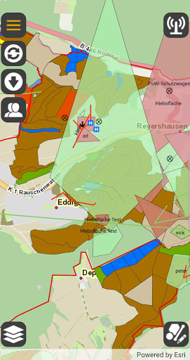
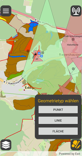
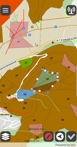
The app enables quick recording of points, areas and lines and retrieval of information from the map.
If there is an internet connection, the data is compared with the inventory on the server.
The Waldinfoplan (WIP) app is based on Esri Runtime 100 and works with Portal for ArcGIS.
In addition to the simple editing options, the app offers many convenient functions.
GPS support makes the editing of points, lines and areas easy and precise even in rough terrain.
Like the forest information plan, the app works on the same database.
This enables the right technology for the respective application and avoids media disruptions.
Many users from the forestry and wood industry use the Waldinfoplan (WIP) app Android / iOS.
The app is always based on the latest Esri products and its licensing is based on Esris.
This means that future-proof technology is available to users.
Social Features
Connect and share with friends and the community.
Fitness Tracking
Track your workouts and monitor your health metrics.
Productivity Tools
Boost your productivity with powerful tools and features.
See the Waldinfoplan in Action
Get the App Today
Available for Android 8.0 and above